Qlik Geo-Analytics
Transform your business with insights from location-based data
Qlik GeoAnalytics lets you make better location-related decisions by offering powerful mapping and location-based analytics. Easily add maps to your applications with automatic geodata lookup and then overlay them with different visualisations. Gain new perspective beyond what you see in tables and charts with built-in support for a broad range of geoanalytic use cases.
Enable users to be more productive with on-the-fly location lookup capabilities. Allow them to improve understanding by exploring all geo-analytics information along with any relationships within one map visualisation thus eliminating the overhead and expense of maintaining and managing access to a separate mapping database.

High-performance, interactive mapping
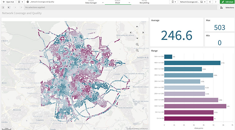
Using innovative technology, Qlik GeoAnalytics transforms the way mapping data is handled by efficiently compressing and streaming it. Seamlessly integrating real-time location lookup, you can effortlessly enhance your Qlik applications with immersive and interactive visualisations of geodata.
The built-in location library is home to millions of predefined places and areas, constantly updating every map in your Qlik application. By unlocking the power of multiple map and visualisation layers, you can explore a wide range of geodata and discover meaningful relationships simultaneously.
Gain geospatial insight
Explore beyond simple map visualisations to gain a deeper understanding and analyse geospatial relationships. Qlik GeoAnalytics offers valuable insights into patterns that may not be easily discernible from reviewing tables or charts.
With the powerful Qlik Associative Engine, you can analyse geodata relationships with non-geodata and even uncover geodata that may seem unrelated. Effortlessly incorporate external geospatial data or map layers into your visualisations or analysis, and you can even import spatial information such as CAD files.
Broad location analytics use cases
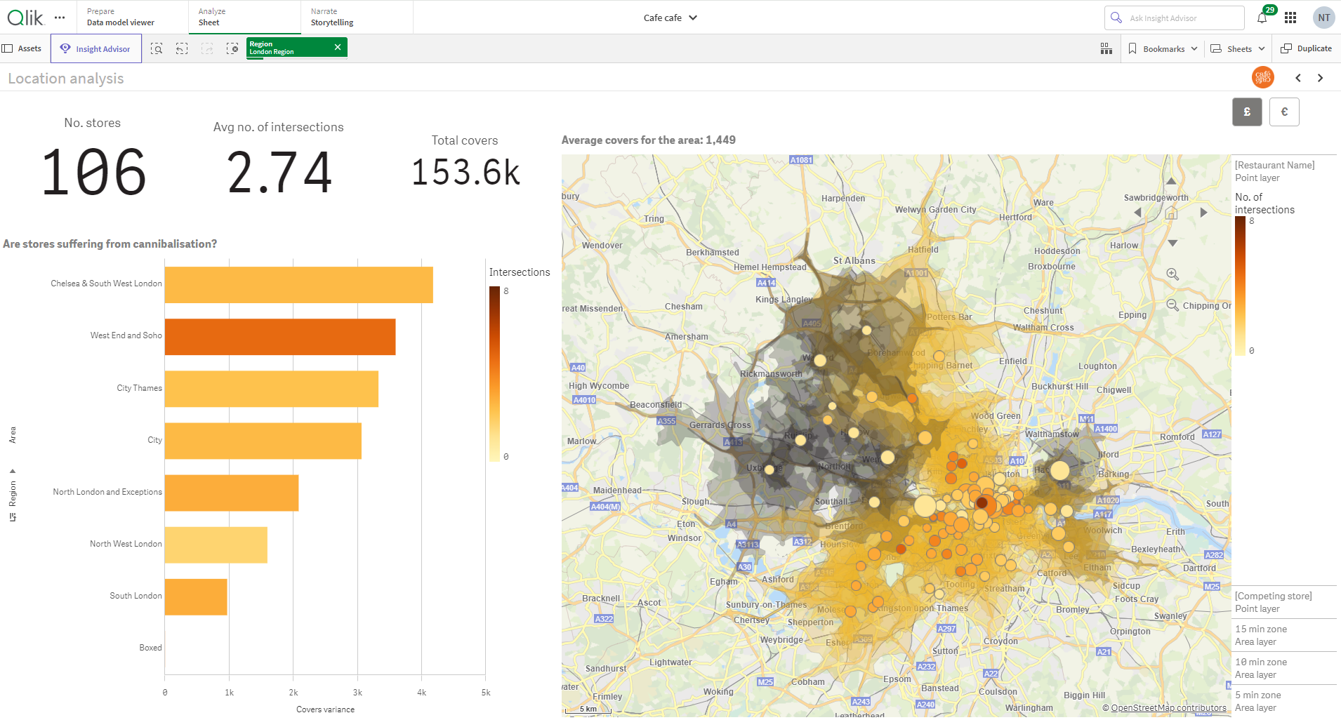
Qlik's extensive range of mapping and geospatial capabilities, equipped with a unified set of tools and technologies, empowers organisations to fulfil a diverse array of location-based needs. Seamlessly deliver mapping and location analytics to all users, both within the organisation and beyond its ecosystem.
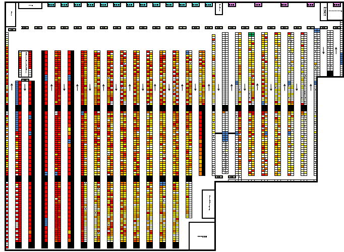
Discover optimal store locations, gain valuable insights into sales distribution by postcode, map a warehouse to optimise picking, and streamline supply chain delivery times. Trust that Qlik GeoAnalytics will seamlessly cater to the specific needs of your geospatial project. With a proven track record of successful implementations across various industries and business functions, our location-based solutions are built on real-world expertise and achievements.
Relevant blogs and webinars in this area
Schedule a Demo
What can you expect?
In short, we offer a simple, honest and interactive demo.
A typical agenda:
- Introductions (5 minutes)
- What are your current challenges (5 minutes)
- High-level slides inc. pricing (5 minutes)
- Product demo and continuous Q&A (40 minutes)
Outcomes:
- An in-depth technical demo
- A link to pricing and a bespoke proposal
But, this is your meeting, your time, so feel free to focus us on what you need from the call.


